mayer xiao's Posts (18)
Sort by
Integrating the TS1224 Laser Rangefinder Sensor with ESP32 for UAV Applications
As unmanned aerial vehicles (UAVs) continue to evolve toward higher autonomy and intelligence, accurate and reliable distance measurement has become a critical requirement. From terrain following and obstacle avoidance to precision landing and altitude control, UAV systems rely heavily on compact sensing solutions that can deliver stable performance in dynamic environments.
The TS1224 laser rangefinder sensor, when integrated with the ESP32 microcontroller, provides a powerful and flexible solution for UAV distance measurement and control applications.
Why Laser Rangefinders Matter in UAV Systems
Unlike ultrasonic or infrared sensors, laser rangefinder sensors offer longer measurement ranges, higher accuracy, and stronger resistance to ambient light interference. These advantages make them especially suitable for outdoor UAV operations, where lighting conditions, wind, and surface reflectivity can vary significantly.
Typical UAV use cases for laser rangefinder sensors include:
Precise altitude measurement and terrain following
Obstacle detection and collision avoidance
Autonomous takeoff and landing (ALT hold & precision landing)
Payload positioning and distance-based navigation
Overview of the TS1224 Laser Rangefinder Sensor
The TS1224 laser rangefinder sensor is designed for embedded and mobile platforms that require compact size, low power consumption, and high measurement stability.
Key features include:
High-precision laser distance measurement
Compact and lightweight design suitable for UAV payloads
Fast response time for real-time control systems
Stable performance in outdoor and varying light conditions
Support for common digital communication interfaces
Its small form factor allows easy installation on drones without significantly impacting flight dynamics or payload capacity.
Why Choose ESP32 for UAV Integration
The ESP32 is a popular choice for UAV developers due to its high processing capability, low power consumption, and rich peripheral support. With built-in Wi-Fi and Bluetooth, ESP32 also enables wireless telemetry, debugging, and data transmission.
Benefits of using ESP32 in UAV projects include:
Dual-core processor for sensor fusion and control tasks
Multiple UART, I²C, and SPI interfaces for sensor integration
Low power modes suitable for battery-powered systems
Strong ecosystem and community support
When paired with the TS1224 laser rangefinder sensor, ESP32 can efficiently handle real-time distance data processing and communication with flight controllers.
TS1224 and ESP32 Integration Architecture
In a typical UAV setup, the TS1224 laser rangefinder sensor communicates with the ESP32 via a serial interface such as UART. The ESP32 reads distance data, applies filtering or calibration algorithms, and then sends processed information to the flight control system (e.g., PX4 or ArduPilot).
A simplified data flow looks like this:
TS1224 measures real-time distance to ground or obstacle
ESP32 receives and parses distance data
Data is filtered and validated
Processed distance data is sent to the UAV flight controller
Flight controller adjusts altitude, speed, or trajectory accordingly
This architecture ensures fast response and high reliability, even in complex flight scenarios.
UAV Application Scenarios
1. Altitude Hold and Terrain Following By continuously measuring the distance between the UAV and the ground, the TS1224 enables precise altitude control, especially at low altitudes where barometric sensors become less reliable.
2. Obstacle Avoidance Mounted on the front, bottom, or sides of a UAV, the sensor helps detect obstacles such as trees, buildings, or terrain changes, improving flight safety.
3. Precision Landing During automated landing, the laser rangefinder provides accurate height data, allowing smooth and controlled descent even on uneven surfaces.
Advantages of TS1224 + ESP32 for UAV Developers
High measurement accuracy with fast response
Compact and lightweight solution optimized for drones
Easy integration with ESP32 and popular UAV platforms
Scalable for custom algorithms and AI-based navigation
Suitable for research, industrial drones, and commercial UAVs
Conclusion
The integration of the TS1224 laser rangefinder sensor with ESP32 offers UAV developers a reliable and flexible distance measurement solution. Whether used for altitude control, obstacle avoidance, or autonomous navigation, this combination delivers the performance and adaptability required for modern UAV applications.
As UAV technology continues to advance, compact laser rangefinder solutions like the TS1224 will play an increasingly important role in enabling safer, smarter, and more autonomous flight systems.
Enhancing UAV Applications with the TS1224 Laser Rangefinder(LRF) Module
Unmanned Aerial Vehicles (UAVs) are increasingly used in diverse fields such as surveying, mapping, agriculture, search and rescue, and defense. A crucial component that greatly improves UAV performance is a reliable laser rangefinder. Our TS1224 Laser Rangefinder Module is designed specifically to meet the needs of UAV developers and enthusiasts, providing long-range, high-precision distance measurement in a compact and rugged form factor.
Key Features of the TS1224 Laser Rangefinder Module
Long Measurement Range: Capable of measuring distances from 5m up to 2000m, making it suitable for both short-range navigation and long-distance observation.
High Accuracy: Delivers precision of ±1m at ranges below 200m and ±0.5% for longer distances, ensuring reliable data for UAV flight control and mapping applications.
Compact and Lightweight: With dimensions of 25.72 × 24.6 × 13.4 mm and a weight of only 10g, the TS1224 is easy to integrate into drones without adding significant payload.
Rugged Design: Built with a metal housing, the module ensures durability and resistance against environmental stress, ideal for outdoor UAV missions.
Wide Temperature Range: Operates reliably between -20°C and +50°C, and can be stored at -40°C to +70°C, making it suitable for extreme field conditions.
Eye-Safe Laser Technology: Uses a 905nm Class 1 invisible laser, certified to IEC 60825-1, ensuring human eye safety during operation.
Low Power Consumption: Consumes only 210mW at 3.3V, making it energy-efficient for UAV systems where battery life is critical.
Stable Communication: Supports UART interface with TTL (3.3V) level and a default baud rate of 115200bps for easy integration with flight controllers and onboard computers.
Advantages of Using TS1224 LRF Module on UAVs
Obstacle Detection and Avoidance By providing accurate distance measurements in real-time, the TS1224 helps UAVs detect and avoid obstacles such as trees, power lines, or buildings, ensuring safer flight operations.
Altitude Measurement The module enables precise altitude measurement above ground level, which is essential for terrain-following flights, precision agriculture, and low-altitude surveying.
Target Ranging for Mapping and Surveillance With its long 2000m range, the TS1224 can be used in aerial surveying, wildlife monitoring, and surveillance missions, allowing UAVs to measure distances to objects or terrain features from afar.
Compact Integration Its miniature size and lightweight body allow UAV designers to integrate the module even in small drones, without compromising flight endurance or maneuverability.
Reliability in Harsh Conditions The metal enclosure and wide operating temperature range make the TS1224 reliable for UAVs operating in deserts, cold climates, or high-altitude environments.
Applications in UAV Systems
Aerial Mapping and Surveying: Accurate distance measurement improves the quality of topographic maps and 3D models.
Agriculture: Used for precision altitude control in crop spraying drones and field monitoring UAVs.
Search and Rescue: Helps drones measure distances to terrain features and navigate safely in complex environments.
Industrial Inspections: Ideal for drones inspecting tall structures, wind turbines, or transmission lines.
Defense and Security: Supports UAV-based reconnaissance by providing reliable ranging data at long distances.
Conclusion
The TS1224 Laser Rangefinder Module is an excellent choice for UAV developers looking for a compact, efficient, and precise distance measurement solution. Its long-range performance, lightweight design, and rugged construction make it highly adaptable for various drone applications. Whether for obstacle avoidance, altitude measurement, or target ranging, the TS1224 enhances UAV capabilities and ensures safer, smarter, and more reliable operations.
Welcom to contact us: https://lasersensor.net
Over the past few months, I’ve been working on a new drone build for surveying and mapping in mixed environments — from open fields to tree-dense areas. One of the biggest challenges I’ve faced is maintaining accurate altitude over uneven terrain and avoiding obstacles without relying entirely on GPS or visual navigation.
That’s when I decided to try integrating a laser rangefinder sensor into my UAV setup. I’ve used ultrasonic sensors before, but their range and accuracy were always limited, especially in windy conditions or when flying over irregular surfaces.
I ended up testing a TS1224 long-range laser rangefinder module from Meskernel Integrated Technology, and the difference was huge. This little module can measure distances up to 2000 meters with ±1 m accuracy, and it works great even when lighting changes — something that often confuses camera-based systems.
Here’s what I’ve been using it for:
Obstacle Avoidance: Detecting trees, poles, and other UAVs before getting too close.
Precise Altitude Holding: Maintaining a stable height when flying over hilly or forested areas.
Survey Assistance: Getting instant, accurate distance readings to ground targets.
The module is surprisingly lightweight and supports multiple interfaces like UART, RS232, and RS485, so it’s been easy to integrate into my flight controller setup. For smaller builds, they also have compact millimeter-precision sensors in the LDL-T series, which are perfect for indoor inspection drones.
For anyone here who’s into DIY drone builds and wants to push their navigation accuracy further, I highly recommend giving laser rangefinder sensors a look. They’ve definitely changed the way I fly.
You can check out the specs and integration options here: https://www.lasersensor.net
Enhance Your Drone's Eyes: Integrating Laser Rangefinder Sensors for Obstacle Avoidance, Precision Altitude, and Distance Measurement
As drone applications expand across industries—from aerial mapping and surveying to agriculture, inspection, and autonomous delivery—the demand for smarter, safer, and more precise onboard sensing grows rapidly.
Laser rangefinder sensors are becoming essential components in UAV systems due to their accuracy, compactness, and fast response. By integrating these sensors into your drone platform, you can unlock a wide range of advanced capabilities:
Key Applications of Laser Rangefinder Sensors in UAVs
Real-Time Obstacle Avoidance Drones can detect obstacles like trees, buildings, power lines, and terrain in real-time and adjust their flight path accordingly to prevent collisions.
Accurate Altitude Measurement Precisely measure the drone’s height from the ground, enabling stable hovering, terrain following, and safe landing—even over uneven surfaces.
Target Distance Monitoring Measure the distance between the drone and remote objects for tasks such as inspection, payload delivery, or surveillance missions.
Topographic Mapping and Surveying Support accurate geospatial data collection in photogrammetry, construction monitoring, and land analysis.
Precision Agriculture Help drones maintain optimal flight altitude over crops to enable uniform spraying and data collection.
Safe Takeoff and Landing Provide height feedback during takeoff/landing, particularly in GPS-denied or visually challenging environments.
Low-Altitude Terrain Following Maintain consistent clearance over ground in hilly or forested environments, essential for forestry or environmental monitoring missions.
Top Laser Rangefinder Modules for UAV Integration
TS1224 Laser Rangefinder Sensor – “Rugged Miniature Pro”
Range: Up to 2000 meters
Accuracy: ±1 meter
Key Features:
Ultra-compact size for seamless UAV integration
Durable metal housing for harsh temperature and environmental conditions
Ideal For: Long-distance terrain mapping, high-altitude operations, drones used in extreme environments (heat/cold), and fixed-wing platforms
TC25 Laser Rangefinder Sensor – “Streamlined Cylindrical Performer”
Range: Up to 1500 meters
Accuracy: ±1 meter
Key Features:
Sleek cylindrical design makes installation easy and space-efficient
Lightweight and compact for multi-rotor and VTOL drones
Ideal For: UAVs with limited payload space, obstacle detection, inspection missions in industrial or urban settings
PTFS Laser Rangefinder Module – “High-Speed Close-Range Eagle”
Range: Up to 1300 meters
Accuracy: ±1 meter
Key Features:
Ultra-high frequency up to 500Hz for fast close-range measurements
Rapid response ideal for dynamic environments
Ideal For: High-speed obstacle avoidance, low-altitude flying, fast-paced inspection tasks, autonomous navigation in GPS-denied areas
Why Choose Our Laser Rangefinder Solutions for Your Drone?
| Feature | Benefi |
| Wide Range Options | 1300m to 2000m—ideal for short to long-range UAV missions |
| Compact & Lightweight | Designed for easy integration into drone payloads |
| High Precision | ±1 meter accuracy ensures reliable measurements |
| Fast Response | Up to 500Hz for real-time obstacle detection and terrain following |
| Industrial Durability | Rugged materials, heat/cold resistance, shockproof design |
| Versatile Interfaces | Compatible with common flight controllers and development platforms |
Integrate laser precision into your drone system and elevate its intelligence. Whether you're building for inspection, mapping, or autonomous flight, our TS1224, TC25, and PTFS laser rangefinders offer unmatched reliability, accuracy, and performance.
For more technical specifications and integration guidance, visit Meskernel
Over View
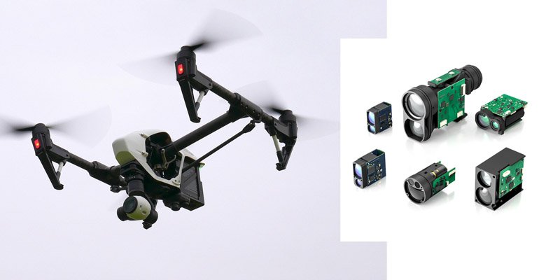
Chengdu, China — Chengdu Meskernel Integrated Technology Co., Ltd. proudly introduces a breakthrough solution in UAV sensing: a laser rangefinder lidar sensor for drone applications, offering ultra-long-range measurement, altitude tracking, and intelligent obstacle avoidance. This state-of-the-art module utilizes 905nm pulsed infrared laser technology, delivering exceptional accuracy and performance for commercial and industrial drones.
As drones continue to evolve into essential tools across sectors like surveying, logistics, agriculture, and infrastructure inspection, the demand for high-precision, lightweight, and long-range lidar sensors has skyrocketed. Meskernel’s latest offering addresses this need with a robust, compact, and cost-effective 1D lidar sensor that brings centimeter-level intelligence to airborne platforms.
Unmatched Performance for Professional UAV Applications
At the core of this sensor lies a powerful 905nm pulsed laser rangefinder sensor capable of measuring distances up to 3000 meters. Despite its long-range capabilities, it maintains a high level of accuracy between 0.5 to 1 meter, ensuring reliable data even in high-speed or high-altitude flight scenarios.
Key Specifications:
- Max Range: Up to 3000 meters (reflective targets)
- Accuracy: ±0.5–1 meter
- Wavelength: 905nm (pulsed laser)
- Measurement Principle: Time-of-Flight (ToF)
- Interface: TTL / RS232 / RS485 / USB / Bluetooth
- Form Factor: Lightweight and compact for seamless drone integration
- Frequency: 1–3Hz (customizable for application needs)

Three Core Drone Applications
1. Distance Measurement (Ranging)
Whether surveying large areas or scanning long-distance targets, drones need precise distance feedback. This sensor provides real-time range data critical for geospatial mapping, forest management, and terrain profiling. It replaces bulky total stations or short-range modules with a highly efficient infrared laser distance sensor.
2. Altitude Control
For UAV stability, especially during takeoff, landing, or hovering, accurate altitude feedback is crucial. Our laser rangefinder lidar sensor for drone use delivers fast and precise altitude readings over natural terrain, water surfaces, or man-made structures—without being affected by lighting or texture conditions.
3. Obstacle Avoidance
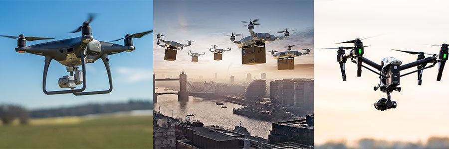
The module’s narrow beam and long detection range enable advanced obstacle avoidance in complex environments. It provides drones with the ability to identify and respond to trees, buildings, towers, or other aerial obstructions early—essential for BVLOS (Beyond Visual Line of Sight) and autonomous flight missions.
Advantages Over Traditional Sensors
Compared to ultrasonic sensors or vision-based systems, our 1D lidar sensor performs reliably in a wide range of environmental conditions including bright sunlight, fog, and rain. Its ToF-based measurement ensures high speed and stability over reflective and non-reflective surfaces alike.
Easy Integration & Global Applications
Our sensor supports common development and flight control platforms, including Arduino, Raspberry Pi, Pixhawk, and industrial PLCs, offering wide compatibility for system integrators and OEMs. With minimal size and weight, it is ideal for multi-rotor drones, fixed-wing UAVs, and vertical takeoff and landing (VTOL) aircraft.

This sensor is already being used in:
- Pipeline inspection drones
- Agricultural spraying UAVs
- Search and rescue drones
- Survey and mapping UAVs
- Border patrol and infrastructure inspection systems
Why Choose Meskernel?
With years of experience in lidar sensors and laser core chip design, Meskernel is known for producing high-performance modules with compact footprints. All sensors undergo strict calibration and testing to ensure stability, reliability, and long-term durability in real-world conditions.
With over 20 years of experience, Meskernel is a trusted expert in laser sensing technology. Backed by a professional R&D team of more than 40 engineers and a 6,000㎡ manufacturing facility, we deliver high-performance, reliable laser rangefinder and lidar solutions for drones, robotics, and industrial applications worldwide.
Ready to Elevate Your Drone’s Sensing Capabilities?
If you are looking for a drone-compatible, high-precision, our laser rangefinder lidar sensor for drone applications is your ideal choice.
